Severe Thunderstorm Watch In Effect For 10 NJ Counties, NWS Warns Severe Thunderstorm Watch In Effect For 10 NJ Counties, NWS Warns Severe Thunderstorm Watch In Effect For 10 NJ Counties, NWS Warns
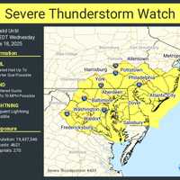
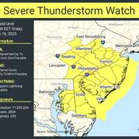
Severe Thunderstorm Watch In Effect For 10 NJ Counties, NWS Warns A Severe Thunderstorm Watch is in effect for 10 New Jersey counties through 7 p.m. Wednesday, June 18, as damaging storms threaten to slam the region with hail, wind, and lightning, according to the National Weather Service. The counties under watch include: Atlantic, Burlington, Camden, Cape May, Cumberland, Gloucester, Mercer, Monmouth, Ocean, and Salem. The Storm Prediction Center says conditions are right for frequent lightning, heavy downpours, and wind gusts strong enough to cause property damage and power outages. Meanwhile, residents in northeast New Jersey—including Passaic, Berg…
Heat Advisory Issued In NJ/PA: Here’s Where Temps Will Feel Like 100° Heat Advisory Issued In NJ/PA: Here’s Where Temps Will Feel Like 100° Heat Advisory Issued In NJ/PA: Here’s Where Temps Will Feel Like 100°
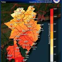
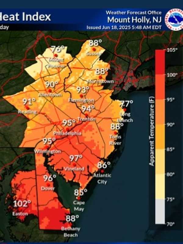
Heat Advisory Issued In NJ/PA: Here’s Where Temps Will Feel Like 100° The National Weather Service has issued a Heat Advisory for parts of New Jersey and Pennsylvania, with “heat index values up to 99 expected” and the potential for it to feel even hotter in the sun. The advisory is in effect from 11 a.m. Wednesday, June 18, through 8 p.m. Thursday, June 19, as dangerously high temperatures and humidity grip the region. ⚠️ Heat Advisory Areas Include: Camden County Gloucester County Northwestern Burlington County Philadelphia County Delaware County “Hot temperatures and high humidity may cause heat illnesses,” officials said in the advisory issued at 2:22 a…
Tornado Confirmed In NY During Severe Storms: Here's When, Where Tornado Confirmed In NY During Severe Storms: Here's When, Where Tornado Confirmed In NY During Severe Storms: Here's When, Where
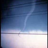
Tornado Confirmed In NY During Severe Storms: Here's When, Where A tornado touched down in New York during a round of storms on Monday, June 9. The National Weather Service in Buffalo investigated storm-related damage from a rotating thunderstorm that affected the area around Great Valley in Cattaraugus County late in the afternoon. The tornado had peak winds of 110 miles per hour and was rated an EF-1 twister, the second-weakest of the six levels on the Enhanced Fujita damage scale. The twister had a path of 2.7 miles from 5:37 p.m. to 5:41 p.m. Several homes, garages, and structures lost walls and roofs. There was also significant …
Tornado And Earthquake Rock Pennsylvania Days Apart; Here's Where Tornado And Earthquake Rock Pennsylvania Days Apart; Here's Where Tornado And Earthquake Rock Pennsylvania Days Apart; Here's Where
Tornado And Earthquake Rock Pennsylvania Days Apart; Here's Where A twister and a tremor shook separate corners of Pennsylvania just days apart, officials say. Surveyors with the National Weather Service confirmed an EF-0 tornado touched down in Clarion County on Tuesday, June 4, bringing 75 mph winds and damaging storms. The tornado carved its path along Brush Run Road, though officials say the exact track has not yet been determined. Crews also examined nearby damage along Haugh Hollow Road and Route 322, but determined that was caused by a downburst or straight-line winds peaking at 80 mph — not tornadic activity. This marks the first confirmed tornad…
Tornado, Hail Possible As Severe Storms Hit Maryland, Virginia Tornado, Hail Possible As Severe Storms Hit Maryland, Virginia Tornado, Hail Possible As Severe Storms Hit Maryland, Virginia
Tornado, Hail Possible As Severe Storms Hit Maryland, Virginia Some severe weather is expected in DC, Maryland, and Virginia as storms approach the region, bringing potential hail and possibly even a tornado, forecasters warn. An alert was issued by the National Weather Service on Sunday, June 8, advising that there is a risk in the DMV region for severe thunderstorms. There is a Slight Risk of severe thunderstorms this afternoon and evening in areas highlighted in yellow. A Flood Watch is also in effect for areas in dark green (second map on the right). #DCwx #MDwx #VAwx #WVwx pic.twitter.com/XMNAp3APJM — NWS Baltimore-Washington (@NWS_BaltWash) Ju…
Tornado Watch Issued In These 10 NJ Counties Tornado Watch Issued In These 10 NJ Counties Tornado Watch Issued In These 10 NJ Counties
Tornado Watch Issued In These 10 NJ Counties The National Weather Service has issued a Tornado Watch for parts of New Jersey, Pennsylvania, Maryland, and Virginia through 12 a.m. Saturday, May 31, with storms expected to begin after 8 p.m. Friday. Here's what to expect: Tornadoes: A couple are possible. Hail: Isolated hail up to ping pong ball size. Wind: Gusts up to 65 mph possible. The watch covers more than 22 million people, including densely populated areas around Philadelphia, Trenton, Atlantic City, Baltimore, Dover, and Virginia Beach. ⚠️ In New Jersey, the watch includes: Atlantic, Burlington, Camden, Cape May, Cumberland…
Tornado, Flood Watches Issued Across DMV As Severe Storms Approach Tornado, Flood Watches Issued Across DMV As Severe Storms Approach Tornado, Flood Watches Issued Across DMV As Severe Storms Approach
Tornado, Flood Watches Issued Across DMV As Severe Storms Approach A powerful storm system is sweeping through the Mid-Atlantic, prompting tornado watches and flood alerts across the DMV region on Friday. The National Weather Service (NWS) has issued a tornado watch effective until 8 PM for parts of central Virginia, the eastern West Virginia panhandle, and surrounding areas, authorities announced.  Severe storms are expected to roll through the region on Friday. National Weather Service A flood watch is also in effect for the entire region, with forecasts predicting up to five inches of rain and the potential for flash flooding. There…
28 Killed, Dozens Injured As Severe Storms, Tornadoes Tear Through 3 States, Including VA 28 Killed, Dozens Injured As Severe Storms, Tornadoes Tear Through 3 States, Including VA 28 Killed, Dozens Injured As Severe Storms, Tornadoes Tear Through 3 States, Including VA
28 Killed, Dozens Injured As Severe Storms, Tornadoes Tear Through 3 States, Including VA A wave of severe weather has resulted in tragedy as multiple tornadoes swept across the central and eastern United States, claiming at least 28 lives, injuring dozens more, and leaving as many as a half-million without power. The event unfolded late Friday, May 16, into Saturday, May 17, leaving a path of destruction across Missouri, Kentucky, and Virginia. Officials say the death toll could rise as they assessed the damage. Southeastern Kentucky has been particularly hard-hit, reporting 21 fatalities, according to CBS affiliate WKYT in Lexington.  Shortly after midnight on Satur…
Winds Up To 70 MPH, Hail, Lightning Expected In NJ, PA: Here's The Timing Winds Up To 70 MPH, Hail, Lightning Expected In NJ, PA: Here's The Timing Winds Up To 70 MPH, Hail, Lightning Expected In NJ, PA: Here's The Timing
Winds Up To 70 MPH, Hail, Lightning Expected In NJ, PA: Here's The Timing Flash flooding is slamming parts of New Jersey and southeastern Pennsylvania Friday, May 16, with more severe weather possible on Saturday, forecasters say. At 11:32 a.m., the National Weather Service in Mount Holly issued a Flash Flood Warning after Doppler radar showed rainfall rates of 2 to 4 inches per hour. Some areas have already recorded an inch of rain. “Flash flooding caused by thunderstorms,” the NWS said. “Flash flooding is ongoing or expected to begin shortly.” The warning is in effect until 3:30 p.m. for the following counties: In New Jersey: Southwestern Mercer, Northwester…
Tornado Confirmed In Northampton County, National Weather Service Says Tornado Confirmed In Northampton County, National Weather Service Says Tornado Confirmed In Northampton County, National Weather Service Says
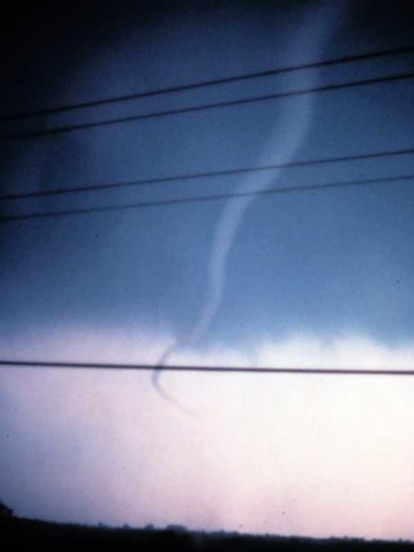
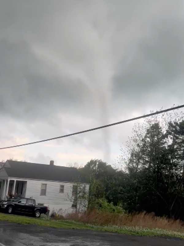
Tornado Confirmed In Northampton County, National Weather Service Says A tornado touched down near Bangor in Northampton County on Tuesday afternoon, May 6, the National Weather Service in Mount Holly confirmed. “We have confirmed a tornado occurred this afternoon near Bangor in Northampton County, PA,” the agency said. “Additional details will follow later this week after a storm damage assessment is completed.” Multiple videos of the twister surfaced before it was confirmed. LIKELY TORNADO ON THE GROUND…Moving towards Bangor, PA. Shot from Bushkill Township, PA. #PAwx @NWS_MountHolly pic.twitter.com/mr1MVtBYAA — joseph martucci (@jtooch07) May 6, 2025 …
Ping Pong-Sized Hail, 70 MPH Winds Threaten North Jersey, Lehigh Valley Ping Pong-Sized Hail, 70 MPH Winds Threaten North Jersey, Lehigh Valley Ping Pong-Sized Hail, 70 MPH Winds Threaten North Jersey, Lehigh Valley
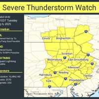
Ping Pong-Sized Hail, 70 MPH Winds Threaten North Jersey, Lehigh Valley A Severe Thunderstorm Watch is in effect until 8 p.m. Tuesday, May 6, for parts of New Jersey and Pennsylvania, the National Weather Service Storm Prediction Center said. Residents in Philadelphia, Trenton, Allentown, Reading, and across North and Central Jersey are impacted, the NWS said. “Isolated thunderstorms have developed over portions of the region,” the National Weather Service said in a Tuesday afternoon update. “The primary threat will be for hail and damaging winds across eastern PA and northern/central NJ.” Threats include: Scattered hail up to ping-pong ball size Wind gusts …
Isolated Tornado Possible, Severe Thunderstorm Watch Issued For 14 NJ Counties Isolated Tornado Possible, Severe Thunderstorm Watch Issued For 14 NJ Counties Isolated Tornado Possible, Severe Thunderstorm Watch Issued For 14 NJ Counties
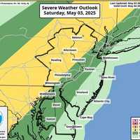
Isolated Tornado Possible, Severe Thunderstorm Watch Issued For 14 NJ Counties A Severe Thunderstorm Watch has been issued for 14 counties in New Jersey, with storms expected to bring wind gusts up to 60 MPH, the National Weather Service said on Saturday, May 3. The watch remains in effect until 11 p.m. for Atlantic, Burlington, Camden, Cumberland, Gloucester, Hunterdon, Mercer, Middlesex, Monmouth, Morris, Ocean, Salem, Somerset, and Warren counties, according to the NWS Storm Prediction Center. Forecasters say the main threat is damaging winds, especially in areas north and west of the I-95 corridor. Showers and isolated thunderstorms will move in later today and co…