Snow, Wintry Mix Delays CT School Openings: Here's Where Snow, Wintry Mix Delays CT School Openings: Here's Where Snow, Wintry Mix Delays CT School Openings: Here's Where
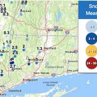
Snow, Wintry Mix Delays CT School Openings: Here's Where Dozens of schools across Connecticut had delayed openings due to a wintry mix that fell into Monday morning, Dec. 16. Some parts of the state saw 4 inches of snow, while others got a light dusting. According to the National Weather Service, the highest amount of snow fell in New Milford (4 inches); Cornwall saw 2.5 inches; Litchfield saw two inches, Waterbury saw 3 inches; Meriden saw 2 inches, and Hartford saw 1.3 inches. According to NBC Connecticut, the following districts had delayed openings: Berlin Public Schools Bethel Public Schools Brooklyn Public Schools Canton Public Schools E…
CT Schools Dismissing Early Due To Extreme Weather Conditions CT Schools Dismissing Early Due To Extreme Weather Conditions CT Schools Dismissing Early Due To Extreme Weather Conditions
CT Schools Dismissing Early Due To Extreme Weather Conditions Schools across Connecticut have announced early dismissals on Wednesday, Dec. 11 due to a storm that is expected to bring up to 60 mph winds and coastal flooding to parts of the state. The following districts are dismissing early: Bolton Public Schools Colchester Public Schools East Hampton Public Schools Groton Public Schools Marianapolis Prep. School (Thompson, CT) Montville Public Schools Preston Public Schools Stonington Public Schools Did we miss one? Email [email protected] The National Weather Service has issued a High Wind Warning for southeast Connecticut, with south winds r…
Town-By-Town Snow Totals: Here's How Much Winter Storm Dropped On CT Town-By-Town Snow Totals: Here's How Much Winter Storm Dropped On CT Town-By-Town Snow Totals: Here's How Much Winter Storm Dropped On CT
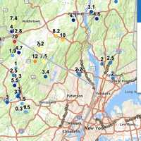
Town-By-Town Snow Totals: Here's How Much Winter Storm Dropped On CT Connecticut residents woke up to a blanket of snow Thursday, Dec. 5. A storm dropped as much as 5.5 inches in some areas, according to the National Weather Service. Lisbon in New London County saw the highest snowfall in Connecticut with 5.5 inches, while Wolcott in New Haven County recorded 4.5 inches. Fairfield County towns, including New Fairfield and Ridgefield, saw up to 3.2 inches. Most other areas across the state reported accumulations between 1 and 3 inches. Here are the snowfall totals reported by the NWS as of Thursday morning, Dec. 5: Fairfield County Ridgefield: 3.0 inches…
What Are Snow Squalls? Winter Weather Hazard Forecast In NJ, PA: Here's What To Know What Are Snow Squalls? Winter Weather Hazard Forecast In NJ, PA: Here's What To Know What Are Snow Squalls? Winter Weather Hazard Forecast In NJ, PA: Here's What To Know
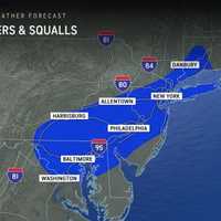
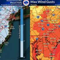
What Are Snow Squalls? Winter Weather Hazard Forecast In NJ, PA: Here's What To Know A storm system moving in brings the potential for snow squalls, 55 mph winds, and frigid temps mid-week in New Jersey and Pennsylvania, forecasters have said in a new update. ⚠️❄️🌬️ Not much change to the forecast for tonight through Thursday. Some snow showers may result in some light... Posted by US National Weather Service Philadelphia/Mount Holly on Wednesday, December 4, 2024 A powerful cold front is set to sweep through the region tonight into Thursday, Dec. 5, bringing snow showers, potential travel hazards, and wind gusts as high as 55 mph, according to the National Weather …
Here's How Much Snow Bergen County Could See Amid Powerful Cold Front This Week: NWS Here's How Much Snow Bergen County Could See Amid Powerful Cold Front This Week: NWS Here's How Much Snow Bergen County Could See Amid Powerful Cold Front This Week: NWS
Here's How Much Snow Bergen County Could See Amid Powerful Cold Front This Week: NWS A powerful cold front is set to move through the region mid-week, bringing light snow and widespread gusts of 40-50 mph, with higher totals in some areas, according to the National Weather Service (NWS). The storm is expected to bring rain and snow showers starting Wednesday night, Dec. 4, with minor snowfall accumulations possible through Thursday morning. Most areas in New Jersey will see less than one inch of snow, while higher elevations in northern counties, such as Sussex and Morris, could receive up to two inches. The bigger concern is the strong winds forecasted for Thursday morning…
Separate Snowmaking Storms Could Mark December's Opening Weeks: Long-Range Outlook Separate Snowmaking Storms Could Mark December's Opening Weeks: Long-Range Outlook Separate Snowmaking Storms Could Mark December's Opening Weeks: Long-Range Outlook
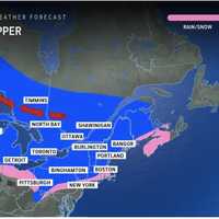
Separate Snowmaking Storms Could Mark December's Opening Weeks: Long-Range Outlook The arrival of an Arctic blast of cold air could be followed by separate snowmaking storms during the first two weeks of December. Tuesday, Dec. 3, will mark the start of a string of days in which Alberta Clipper systems with fast-falling snowfall are possible in these areas shown in pink and blue in the image above from AccuWeather. According to current forecast models, the highest likelihood for snowfall in the Northeast is overnight Wednesday, Dec. 4 into Thursday, Dec. 5, according to the National Weather Service. Areas farther south will likely see mainly snow showers but accumul…
Rain, Winds, Coastal Storm? What NJ Can Expect From The Weather This Thanksgiving Week Rain, Winds, Coastal Storm? What NJ Can Expect From The Weather This Thanksgiving Week Rain, Winds, Coastal Storm? What NJ Can Expect From The Weather This Thanksgiving Week
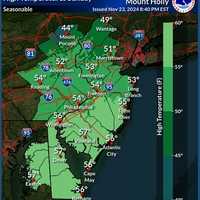
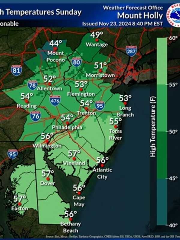
Rain, Winds, Coastal Storm? What NJ Can Expect From The Weather This Thanksgiving Week The National Weather Service in Mount Holly is forecasting a mix of sunny skies, mild temperatures, and rain chances this Thanksgiving week, with a potential coastal storm expected to impact travel plans Thursday into Friday. Here's your day-by-day forecast this week through the holiday, according to the NWS: Sunday, Nov. 24: Expect mostly sunny skies with a high near 56°F. West winds will blow around 15 mph, with gusts as high as 30 mph. Tonight will be partly cloudy, with lows dropping to 33°F and calming winds. Monday, Nov. 25: Sunny and slightly warmer, with a high near 59°F.…
Drought Conditions Intensify Across South Jersey, Extreme Drought Hits Philly Metro Area Drought Conditions Intensify Across South Jersey, Extreme Drought Hits Philly Metro Area Drought Conditions Intensify Across South Jersey, Extreme Drought Hits Philly Metro Area
Drought Conditions Intensify Across South Jersey, Extreme Drought Hits Philly Metro Area Extreme drought conditions are now gripping South Jersey and the Philadelphia metro area, according to the latest update from the National Weather Service (NWS). Drought Monitor update: Extreme drought now covers 36% of our area, including portions of the Philly metro and Delmarva.... Posted by US National Weather Service Philadelphia/Mount Holly on Friday, November 22, 2024 As of Thursday, November 21, extreme drought (D3 classification) covers 36% of the region—the highest extent since August 2002. Portions of Delmarva and the Philadelphia suburbs are among the hardest-hit areas, …
Snow Totals Climb With 20 Inches Recorded In This NJ Town: Check How Much Snow Your Area Got Snow Totals Climb With 20 Inches Recorded In This NJ Town: Check How Much Snow Your Area Got Snow Totals Climb With 20 Inches Recorded In This NJ Town: Check How Much Snow Your Area Got
Snow Totals Climb With 20 Inches Recorded In This NJ Town: Check How Much Snow Your Area Got Snowfall totals in New Jersey and Pennsylvania have surged higher than earlier reports, with some areas now measuring up to 20 inches, the National Weather Service announced Friday, Nov. 22. High Point, NJ, has officially recorded 20 inches of snow as of Friday morning, marking the highest total in the region.  In Pennsylvania, Richmondale follows closely with 19.5 inches, and Cortez reached 19 inches, highlighting the storm's significant impact on higher elevations. Other notable totals include 17.2 inches near Uniondale and 17 inches in Clifford, both in northeastern Pennsylvania. F…
Snow In New Jersey: School Closings, Delays Announced As Winter Weather Worsens Snow In New Jersey: School Closings, Delays Announced As Winter Weather Worsens Snow In New Jersey: School Closings, Delays Announced As Winter Weather Worsens
Snow In New Jersey: School Closings, Delays Announced As Winter Weather Worsens Heavy snowfall and hazardous road conditions have prompted school closures and delays across parts of North Jersey Friday, Nov. 22. Precipitation is expected to continue throughout the day, with snowfall accumulation most significant near and north of the Route 78 corridor in Pennsylvania and northwest New Jersey, according to the National Weather Service in Philadelphia/Mount Holly. Higher elevations are seeing the heaviest impact, officials said. A Winter Weather Advisory is in effect for portions of NE NJ and much of the Lower Hudson Valley from 7pm tonight... Posted by US National W…
Snow Forecast Expands In NJ, PA: Here's How Much Snow Is Now Being Predicted Snow Forecast Expands In NJ, PA: Here's How Much Snow Is Now Being Predicted Snow Forecast Expands In NJ, PA: Here's How Much Snow Is Now Being Predicted
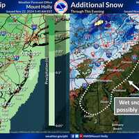
Snow Forecast Expands In NJ, PA: Here's How Much Snow Is Now Being Predicted A powerful low-pressure system is set to bring more snow and rain to the region than initially predicted, with higher elevations now expected to see significant snowfall by Friday evening, Nov. 22 in parts of New Jersey and Pennsylvania. Rainfall amounts have been updated to range from 0.1 to 0.25 inches across much of South Jersey, while northern areas, including Mount Pocono, could see up to 1.5 inches of rain, according to the National Weather Service. In addition to the rain, snow accumulations in higher elevations are expected to be heavier than earlier forecasts: Mount Pocono could no…
Gusty Winds, Possible Snow Heading Toward Maryland, Virginia, Forecasters Caution Gusty Winds, Possible Snow Heading Toward Maryland, Virginia, Forecasters Caution Gusty Winds, Possible Snow Heading Toward Maryland, Virginia, Forecasters Caution
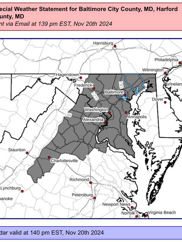
Gusty Winds, Possible Snow Heading Toward Maryland, Virginia, Forecasters Caution Forecasters are cautioning that some wild weather may be moving through the DMV region through the weekend as the area braces for possible snow storms in parts of the area. A "Special Weather Statement" was issued by the National Weather Service advising that wind gusts possibly approaching 50 mph may be on the way on Wednesday night, bringing with it a strong cold front and possibly a taste of winter weather in the mountains. Mild temps continue ahead of strong cold front today. The front will deliver increased rain chances & gusty winds later this evening into tonight. Upper level …